Course Details
Your Growth, Our Mission
Course Description
For Petrotechnical professionals seeking to gain a practical knowledge and understanding of the techniques and concepts used in the seismic interpretation process, this course provides a thorough introduction covering all aspects, from the fundamentals of the seismic method to mapping and the use of seismic attributes. Seismic data, in particular 3D seismic data, is a mainstay of the petroleum industry. Seismic data are used by geophysicists, geologists and engineers alike to image subsurface structure and stratigraphy, identify hydrocarbons, and thereby generate drilling prospects and effectively drain oil and gas reservoirs.
The Training Course Will Highlight ?
Achieving an understanding of all of the methods and concepts used during the interpretation process can be a daunting task. A partial list of disciplines incorporated into a complete interpretation includes rock physics, signal processing, wireline log analysis, computer visualization, structural geology, stratigraphy and petroleum engineering. Few, if any, new hires have mastered, or perhaps even been exposed to, all of these disciplines during their university education. Other, more experienced, petroleum professionals may have become specialists in one of these or other fields, and lack the big-picture view necessary for maximizing the value of a seismic interpretation.
Training Objective
By the end of this course, delegates will be able to:
-
- Explain fundamental aspects of seismic wave propagation, diffractions, and reflection criteria
- Compare 2D and 3D seismic acquisition techniques; evaluate key survey requirements necessary to achieve project objectives
- Assess the importance of key seismic data processing steps including datum and statics corrections, velocity analyses, migration and depth imaging
- Contrast 2D and 3D seismic data benefits, recognize common imaging pitfalls
- Explain how prospect risk factors can influence project objectives and interpretation workflows
- Demonstrate practical interpretation skills; construct and use synthetic seismograms, perform well-seismic ties, 2D line correlation, horizon and fault identification, seismic picking and basic mapping
- Compare seismic time-to-depth conversion techniques and recognize the advantages and disadvantages of different methods
- Determine factors affecting seismic resolution at the reservoir scale
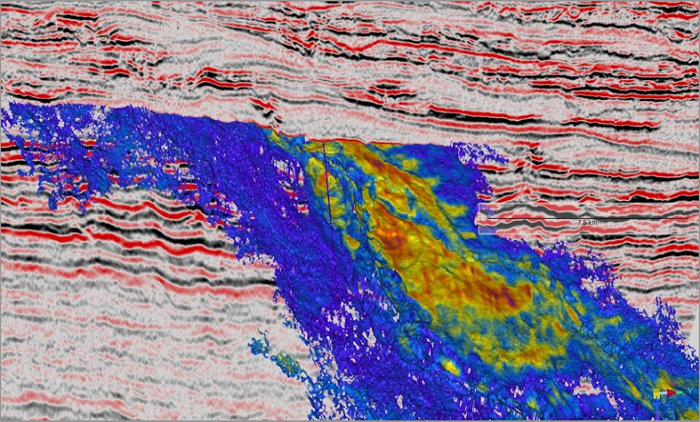
- Differentiate the various types of seismic attributes available and select appropriate attributes for a given project
Target Audience
Geologists, Geophysicists, Reservoir Engineers, Production Engineers, Petrophysicists, Petroleum Engineers, Drilling Engineers, Field Development Engineers, Managers, Asset Managers, Oil & Gas Engineers, Reservoir Operators, Surveillance Engineers, Technicians, Engineering Trainees, Technical Managers, Technical Assistants, Technicians, Chemists, Physicists, Technical Supervisors, Service Company Personnel responsible for improving the performance of petroleum reservoirs, Geotechnical assistants who are involved in seismic interpretation projects, Engineers and Project Managers who would like to learn more about the utilization of seismic data in various project settings
Training Methods
This interactive Training will be highly interactive, with opportunities to advance your opinions and ideas and will include;
- Lectures
- Workshop & Work Presentation
- Case Studies and Practical Exercise
- Videos and General Discussions
Daily Agenda
Course Outline:
-
- Prospect risk factors influencing interpretation workflows
- The seismic method
- Rock properties
- Wave propagation, reflectivity, impedance
- Data acquisition – land and marine
- Seismic data processing overview
- Conventional pre-stack processing and CMP gathers
- Post-stack processing
- Seismic migration, exercises; datum statics, migration
- Calibration methods (well-tie)
- Velocity surveys
- Sonic logs
- Synthetic seismograms
- Exercise; seismic well tie
- Vertical seismic profiles
- Structural Interpretation
- Structural styles
- Fault interpretation
- Exercise - fault plane interpretation
- Horizon interpretation techniques
- Horizon attributes
- Validation methods
- Interpretation pitfalls
- Attributes for lithology, fluids, and rock mechanics
- Acoustic impedance and inversion
- AVO and elastic seismic response
- Pore pressure effects on velocity
- Interpretation tools for unconventional reservoirs
- Modeling and depth conversion tools
- Types of velocity information
- Depth conversion methods
- Workflow: depth conversion using 2-layer model
- Image ray map migration
- PreStack depth migration
- Validation using 2D modeling, ray tracing, and full waveform modeling
- Project planning
- Interpretation techniques
- Issues to consider when building a project on the workstation
- Stratigraphic interpretation of seismic data
- Sequence stratigraphy
- Seismic facies identification
- Seismic tuning amplitudes and Isochron mapping
- Spectral decomposition
- Visualization tools
Accreditation
BTS attendance certificate will be issued to all attendees completing minimum of 80% of the total course duration.
Quick Enquiry
Request Info
Related Courses
Your Growth, Our Mission